Maps: Aldbourne Chase map from 1608
We hope you enjoyed watching our Education Service video with collections expert Rose Mitchell looking at an example from our collection of maps. This video focuses on the beautiful Aldbourne Chase 1608 map from the records of the Duchy of Lancaster, which was created because of a dispute about the royal rabbit warren. Aldbourne Chase is situated north of Salisbury Plain, in Wiltshire.
Watch the video then try and answer the following questions:
- What type of document is it?
- What about the appearance of the document?
- What is the date?
- Who has produced it?
- Who is it for?
- What is the purpose of the document?
- How is this map useful for understanding early Stuart society during the reign of King James I of England, and James VI of Scotland?
- What is the value of a visual source like this map as opposed to a written document?
- How do the other documents mentioned in the video relate to the map?
- Why does the National Archives have this map?
Related Resources
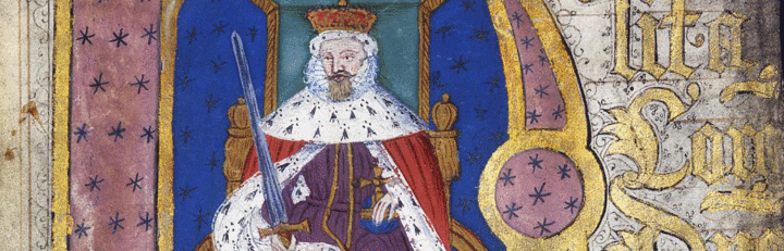
- James I
- What were the key areas of dispute?
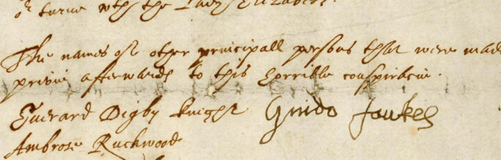
- Gunpowder Plot
- Can you uncover the plans of the plotters?

- Early Modern witch trials
- Who was accused?
Connections to Curriculum
Key stage 5
- AQA GCE History
- Stuart Britain and the Crisis of Monarchy, 1603–1702
- OCR GCE History
- The Early Stuarts and the Origins of the Civil War 1603–1660