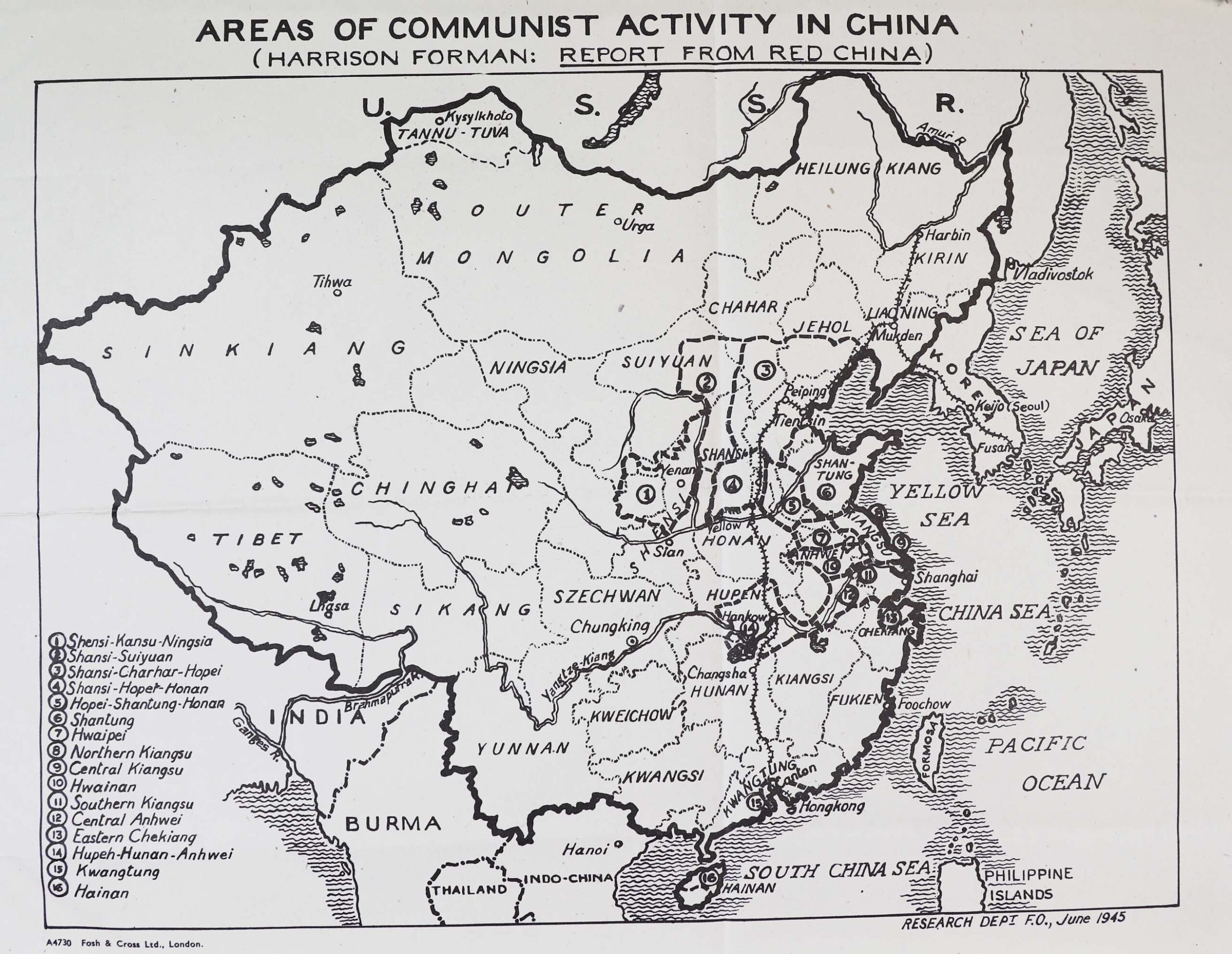
Map: ‘Areas of Communist Activity in China’ from Harrison Forman: ‘Report from Red China’, June 1945. Catalogue ref: WO 208/4398
Harrison Forman (1904-1978) was an American photographer and journalist. He wrote for ‘The New York Times’ and ‘National Geographic’. During the Second World War he reported from China and interviewed Mao Zedong.
Transcript
AREAS OF COMMUNIST ACTIVITY IN CHINA
(HARRISON FORMAN: REPORT FROM RED CHINA)
Key:
- Shensi-Kansu-Ningsia
- Shansi-Suiyuan
- Shansi-Charhar-Hopei
- Shansi-Hopei-Honan
- Hopei-Shantung-Honan
- Shantung
- Hwaipei
- Northern Kiangsu
- Central Kiangsu
- Hwainan
- Southern Kiangsu
- Central Anhwei
- Eastern Chekiang
- Hupeh-Hunan-Anhwei
- Kwangtung
- Hainan
Map description
Map of China with districts labelled and marked out. The areas of China that are under Communist control are differentiated by being outlined in thick black lines and numbered, with numbers corresponding to a key in the bottom left hand side. The Communist-controlled areas all border one another and are clustered in the eastern central part of China, and appear to take up approximately 10-20% of the landmass. The cities Yenan (Yan’an), Shanghai, Tientsin [Tianjin], Peiping [Beijing], and Hankow [Hankou] are marked out in the Communist-controlled areas.
Task 1
Look at this map from June 1945.
- What proportion of China was under Communist control according to the map?
- Can you explain how the KMT might have viewed the situation?
- Why do you think this map was produced?