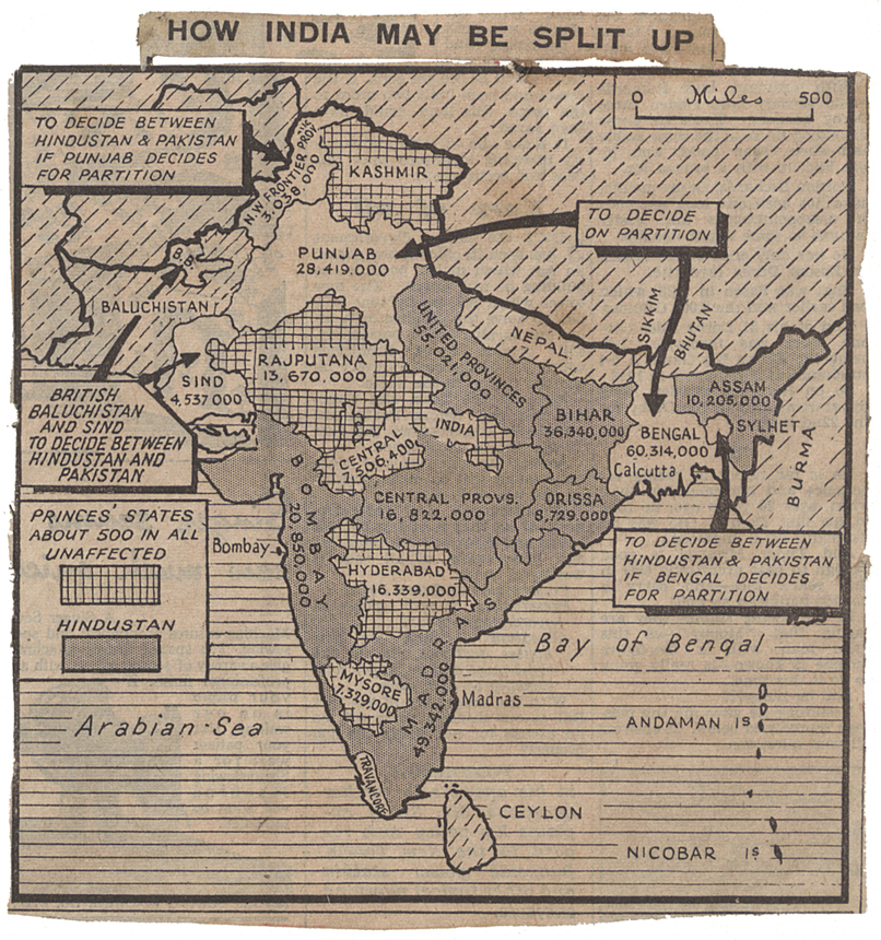
Map speculating on a possible division of India from the Daily Herald newspaper, 4th June 1947 (CAB 21/2038)
Transcript
HOW INDIA MAY BE SPLIT UP
[Arrow pointing to region labelled ‘N. W. Frontier Province 3,038,000’]:
To decide between Hindustan & Pakistan if Punjab decides for partition
[Arrows pointing to a region labelled ‘Sind 4,537,000’ and a small region labelled ‘B.B.’]:
British Baluchistan and Sind to decide between Hindustan and Pakistan
[Arrows pointing to region labelled ‘Punjab 28,419,000’ and ‘Bengal 60,314,000 Calcutta]:
To decide on partition
[Arrow pointing to small region in between regions labelled Bengal, Assam, and Sylhet]:
To decide between Hindustan & Pakistan if Bengal decides for partition