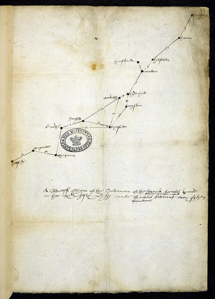
Look at document SP 12/125 (98).
- The words are difficult to read because this is Tudor handwriting. Are there any letters or words you recognise?
- What do you think this document might be?
- What do you think the numbers next to the lines refer to?
This is a sketch map showing the route of Queen Elizabeth’s summer progress of 1578. The map is in fact upside down which makes it even more difficult to understand! At the top right is the word ‘Hampton’. This is Hampton Court, one of Queen Elizabeth’s palaces just outside London. This was where her journey started. The last place name (bottom left) is Thetford, a town in Norfolk. The numbers refer to the miles between each stopping place. It was important to plan the journey carefully to avoid travelling at night and to ensure that Queen Elizabeth was able to sleep in a comfortable bed in safety every night.