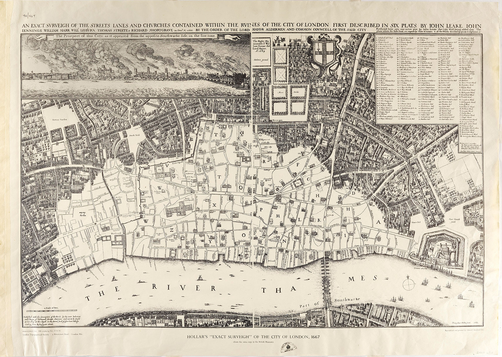
In September 1666, a fire from a bakery in Pudding Lane set fire to the neighbouring wooden houses. The fire spread fast across London. It raged for four days. King Charles II himself joined the rescue efforts. By the time it had been put out the Great Fire of London had destroyed 2/3 of the city of London, and 13,000 buildings. The map was made a few months later to show the extent of the damage. The lighter parts of the map show the spread of the fire. The darker area of the map shows the parts of London that survived the fire. Here you can see the tightly packed houses still standing. Look again at the lighter parts of the map. Some buildings did survive although they had clearly been damaged. The buildings that survived were the stone churches. The largest church was St Paul’s Cathedral. Can you spot it on the map?
Look carefully at the document.
- What type of document is it?
- Point to all the different things you notice in the document.
- Can you work out which place this is?
- When was this document made? Can you find a date on it? (Clue- look at the top of the document)