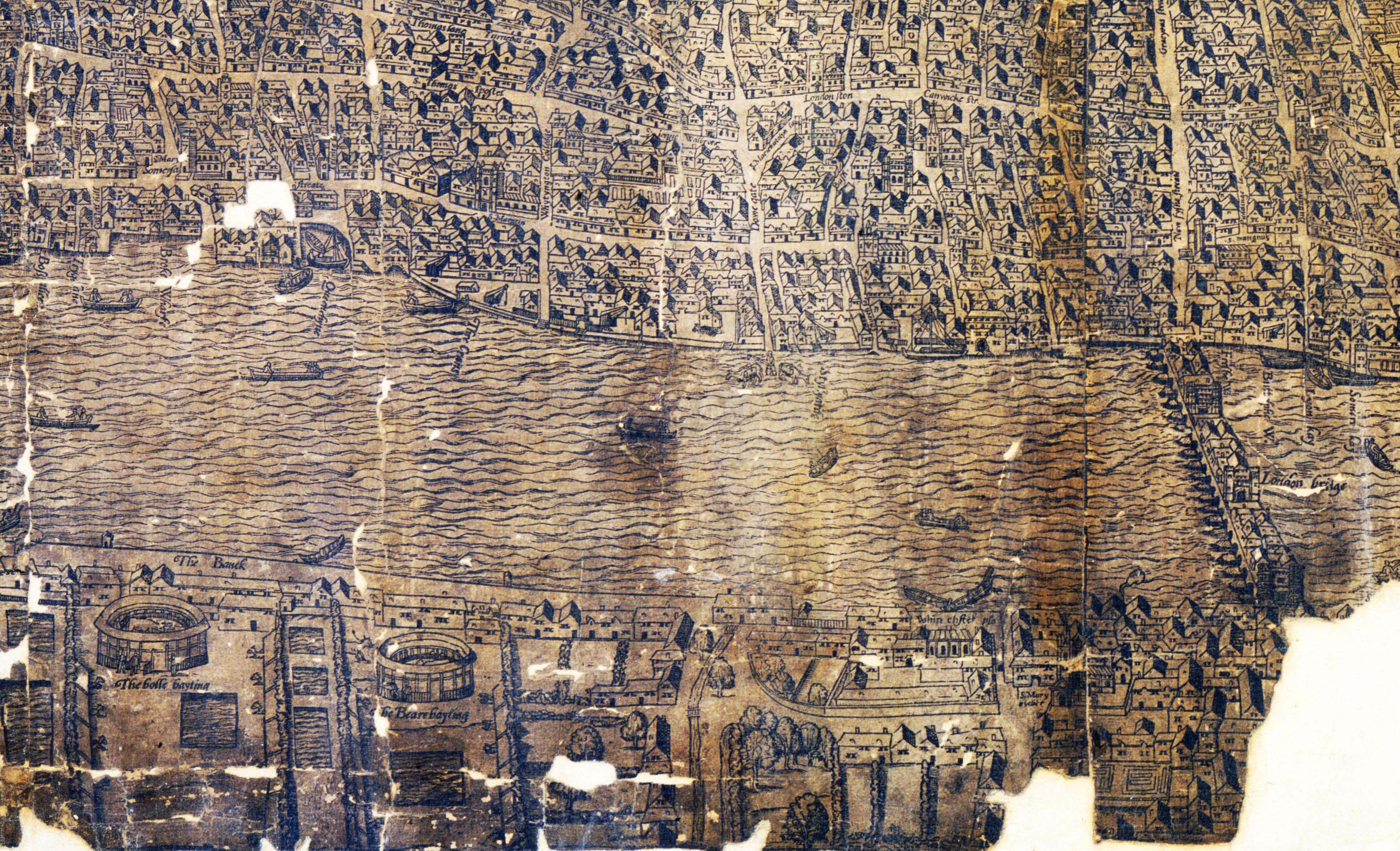
- What activities are held in the round buildings shown on the South Bank of the Thames?
- Why were these buildings built outside of the city?
- What does the map show us about London at the time? (Particularly the difference between the two sides of the river.)