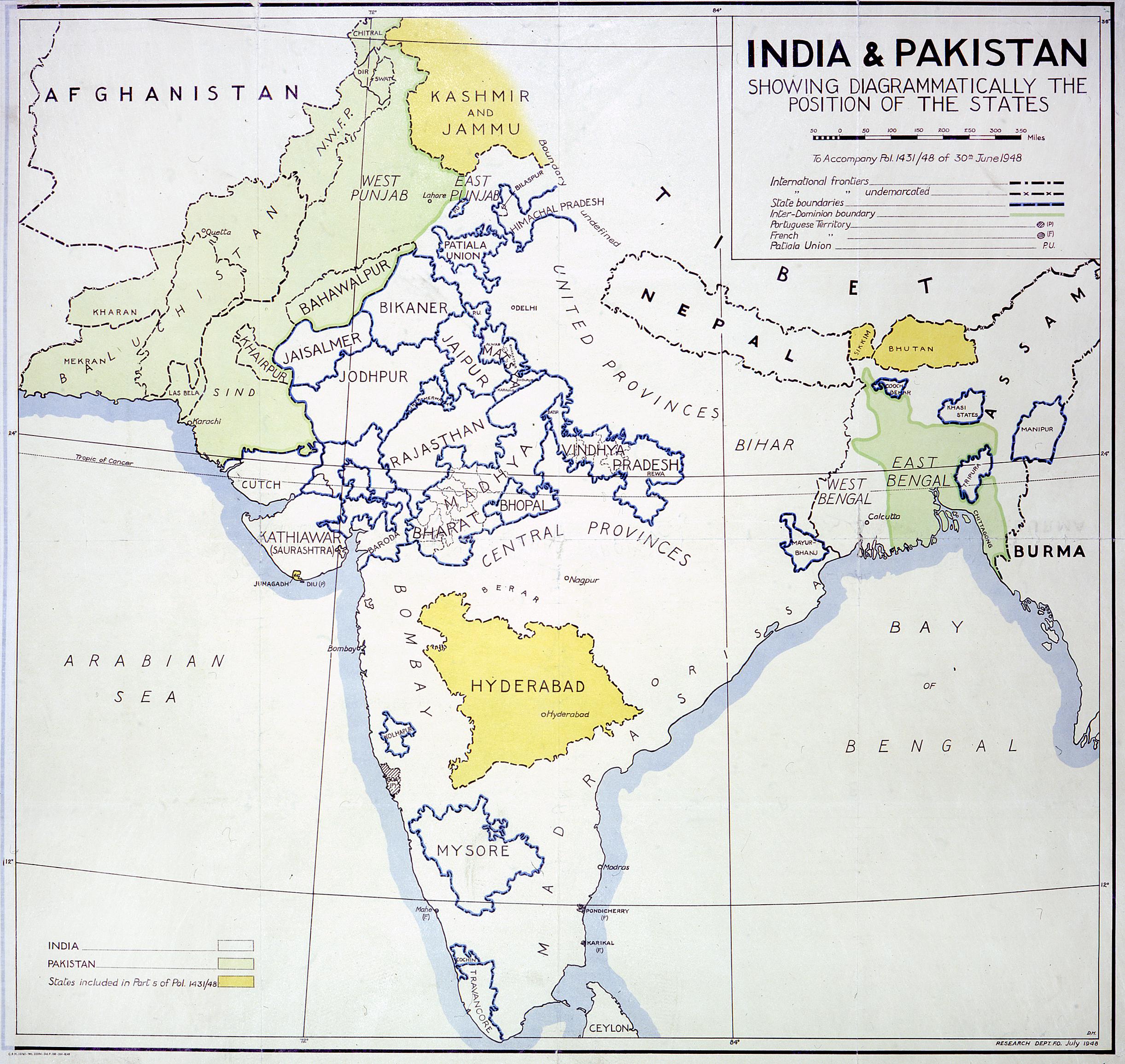
This map shows how British India was divided up after the 1947 partition: into India (majority non-Muslim) and Pakistan (majority Muslim).
India and Pakistan, showing States, and areas allocated to neither new country, 1948. Catalogue ref: MFQ 1/1145
Transcript
INDIA & PAKISTAN
SHOWING DIAGRAMMATICALLY THE POSITION OF THE STATES
To Accompany Pol. 1431/48 of 30th June 1948
International frontiers = [dotted line]
” ” undemarcated = [dotted line with x]
State boundaries = [dotted line with blue]
Inter-Dominion boundary = [green line]
Portuguese Territory = [circle with diagonal lines] (P)
French ” = [circle with horizontal lines] (F)
Patiala Union = P. U.
INDIA = [white]
PAKISTAN = [green]
States included in Part 5 of Pol. 1431/48 = [yellow]
- What do the green areas on the map represent?
- Find East Bengal (later East Pakistan, today’s Bangladesh).
- How far away do you think East Bengal is from West Pakistan?
- What kind of issues do you think might come from a country being made up of two areas so far from each other? Give three suggestions.