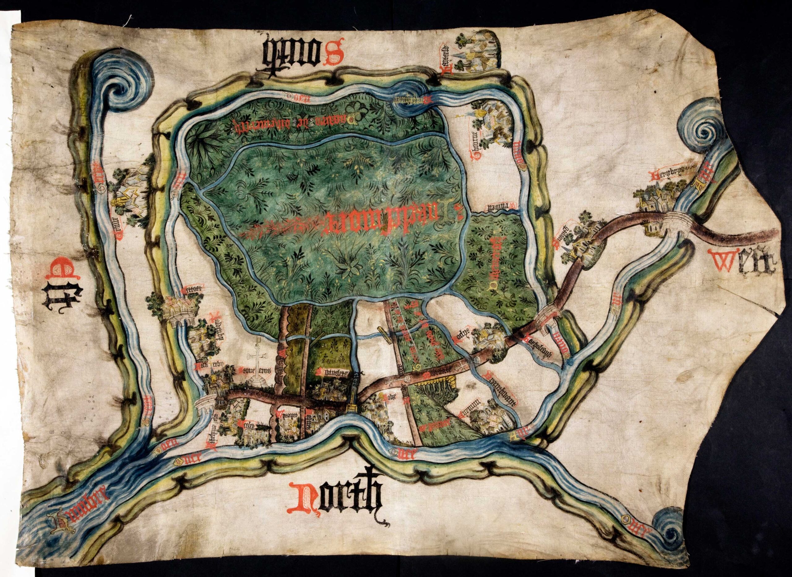
This document is a map from 1407 and records a final agreement in a long-running land dispute between the Duchy of Lancaster, a powerful land-owning family and the abbot of St Mary’s Abbey in York. Catalogue ref: MPC 1/56.
The dispute concerned whom had the right to cut peat to sell for fuel and use different areas of the moor.
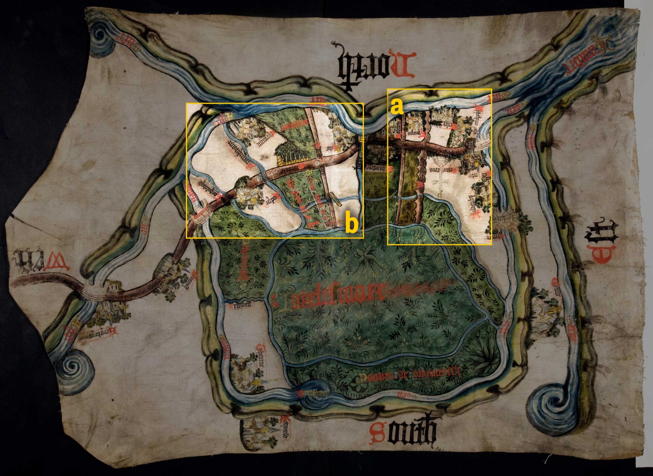
The map was meant to be put on a table so the people involved in the argument could see it. That’s why the words North, South, East and West are written in different directions. In the middle of the map in red it says ‘Inclesmore’, which was the old name for this piece of land. The large stone cross drawn on the map and labelled ‘Stone cros’ (a) is to mark the edge of the land that the abbey was allowed to keep sheep on. The two small stone crosses on the left side of the map (b) drawn on the path mark the land that the abbot and the Duchy shared to cut peat in. The section of land between these two crosses was split into one-third for the Duchy and two-thirds for the abbey. The National Archives also has a simplified version of the map, which was copied into the Duchy’s book of agreements alongside the relevant court cases in case arguments broke out again.

Transcript
Athelyngflet = Adlingfleet
Ucflet = Ousefleet
Wytgyft = Whitgift
Rednes = Little Reedness
Swinflete = Swinefleet
Hoke = Hook
Thourne = Thorne
Hantfeld = Hatfield
Snayth = Snaith
« Return to Medieval agreements and arguments- Can you find the following on the map: river, riverbanks, streams, paths, plants, towns, churches, bridges, houses?
- Why do you think this map is so colourful?
- What shape is the map? Can you explain why?
- What languages can you see on the map?
- Which English words can you read? Why are these included do you think?
- Can you explain any similarities and differences with this map any others you have seen?
- What sort of agreements could a map be used to record?
Look at a modern map of Goole and Thorne Moor and the surrounding towns and see if you can match up the area with the medieval map.
- What has changed?
- What has stayed the same?
- Can you find any of the town names?