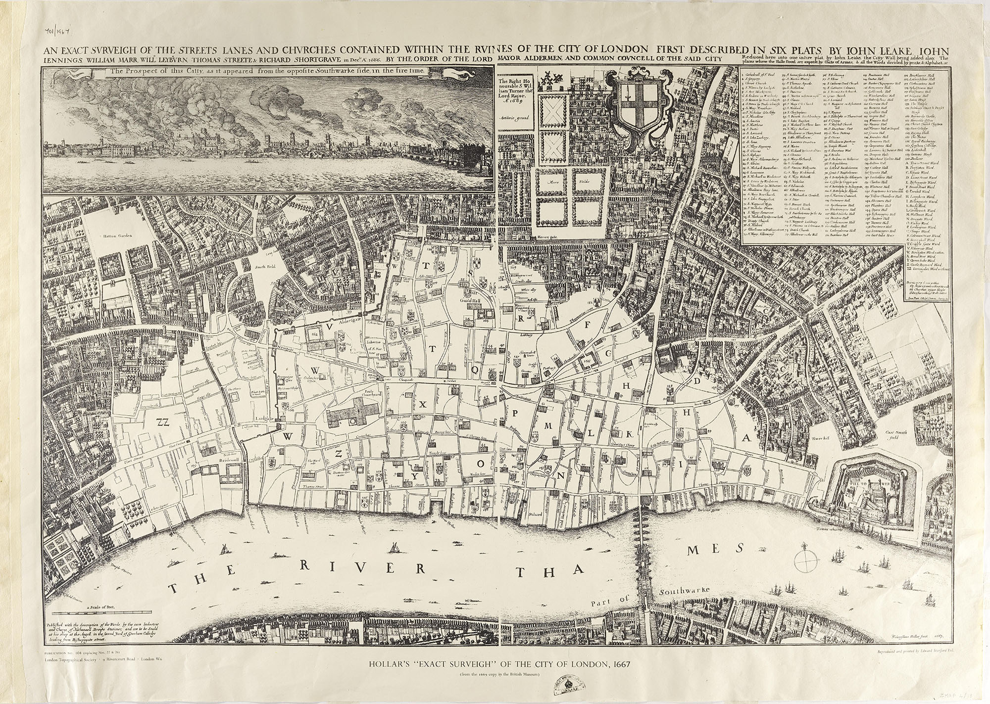
Map showing London after the fire 1667 (ZMAP 4/18)
Transcript
AN EXACT SURVEIGH OF THE STREETS LANE AND CHURCHES CONTAINED WITHIN THE RUINES OF THE CITY OF LONDON FIRST DESCRIBED IN SIX PLAT[E]S BY JOHN LEAKE, JOHN JENNINGS, WILLIAM MARR, WILL LEYBURN, THOMAS STREETE & RICHARD SHORTGRAVE in December Anno 1666. BY THE ORDER OF THE LORD MAYOR ALDERMEN, AND COMMON COUNCELL OF THE SAID CITY
Reduced here into one intire plat[e], by John Leake, the City Wall being added also. The places where the Halls stood are exprest by Coats of Armes, & all the Wards divided by pricks & Alphabet.
The Prospect of this Citty, as it appeared from the opposite Southwarke side, in the fire time.
HOLLAR’S “EXACT SURVEIGH” OF THE CITY OF LONDON, 1667
(from the 1669 copy in the British Museum)
3. Wenceslaus Hollar drew this map.
- Can you find the following places on the map?
- River Thames
- Tower of London
- St Paul’s Cathedral (Clue: from above it looks like a cross, not a dome)
- Pudding Lane (Clue: north of the river, near the bridge)
- Why are there not many buildings shown in the white middle part of the map?
- Ask your teacher for a map of London today. Try and spot the differences with Hollar’s map of London.