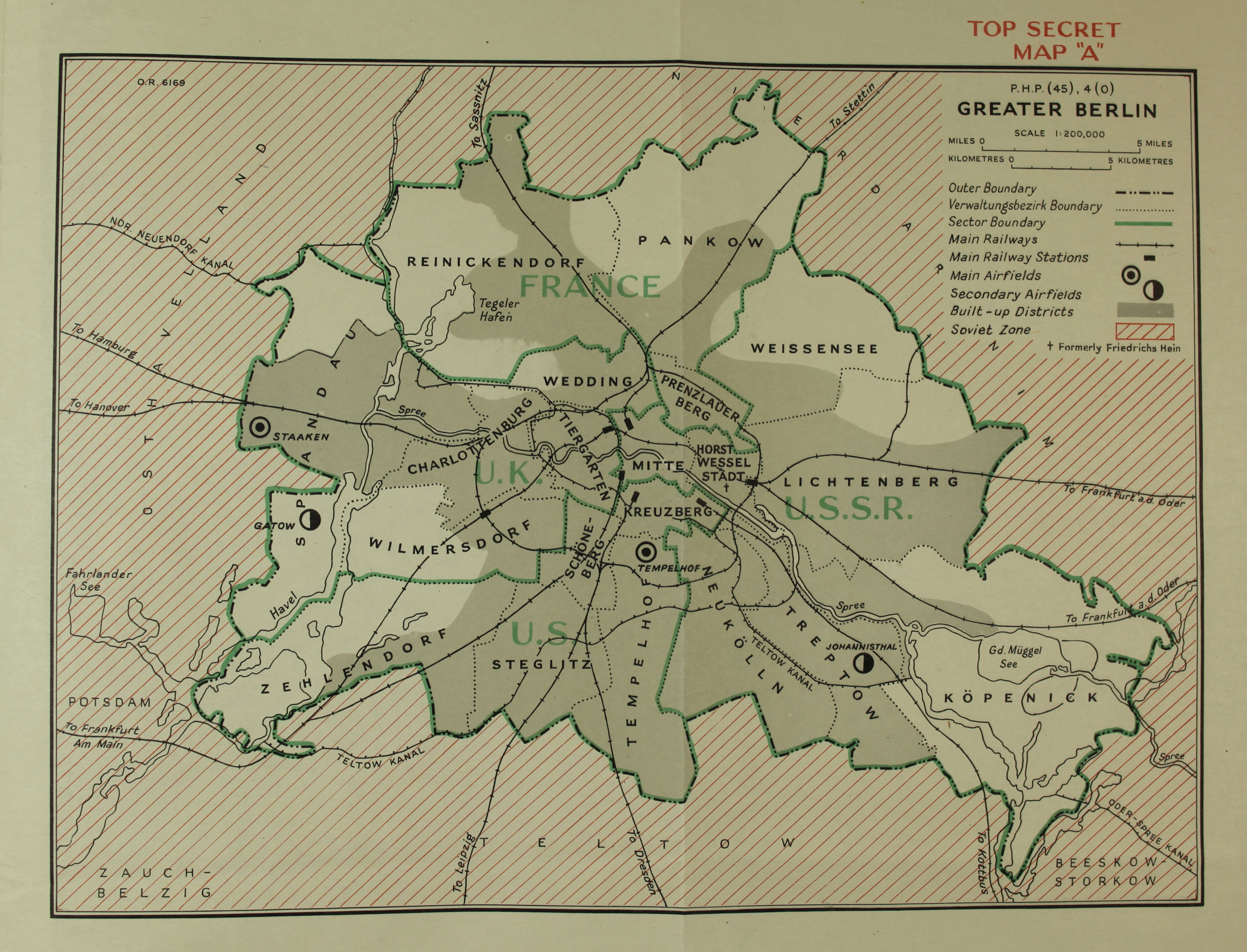
Foreign Office map showing occupation of Berlin in 1948 (Catalogue ref: FO 371/50831)
Read accessible description of this map.
Transcript:
TOP SECRET MAP “A”
P.H.P. (45), 4 (0)
GREATER BERLIN
SCALE 1:200,000
Outer Boundary: [line consisting of repeated pattern of dashes followed by two dots]
Verwaltungsbezirk Boundary: [dotted line]
Sector Boundary: [green line]
Main Railways: [line with vertical dashes across it]
Main Railway Station: [black rectangle]
Main Airfields: [circle containing dot]
Secondary Airfields: [half-black circle]
Built-up Districts: [grey]
Soviet Zone: [diagonal red stripes]
[cross]: Formerly Friedrichs Hein