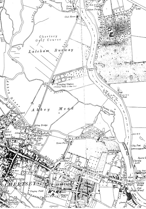
Map description
Map that shows a river flowing downwards through a number of fields. On its right at the top of the map is a building labelled ‘Laleham House’. Near the bottom of the map the river flows underneath a bridge labelled ‘Landing Bridge’.
Above the bridge, the river branches off to the left, now called ‘Abbey River’, and flows around an area labelled ‘Abbey Mead’. Below Abbey River is an area called ‘The Abbey (Site of)’, at the top of the town of Chertsey.
2. Look at this map of Chertsey drawn in the 20th century. Compare it to your map of medieval Chertsey.
- Which parts of medieval Chertsey are still standing today?
- List all the differences you can see
- What buildings do you think are the most important ones in Chertsey today?
- How accurate do you think this map is?