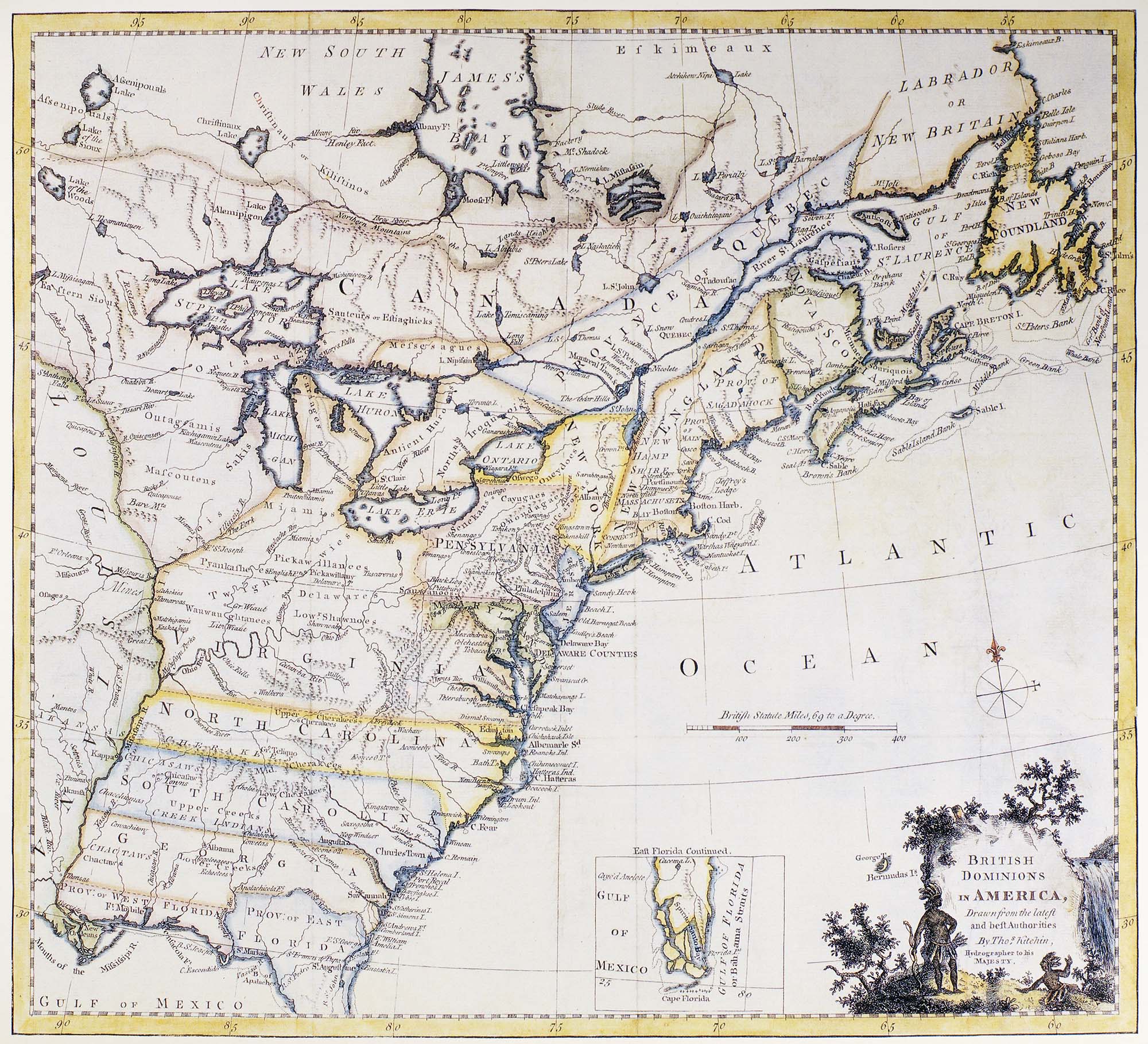
A map showing the British colonies and provinces in America, by Thomas Kitchin, ‘Hydrographer to his Majesty’ c.1770. Copyright Bridgeman Images.
A hydrographer was a person who measured water depth and searched for rocks and wrecks that could be hazards to navigation and collected information on tides and currents.
Visual description
Map showing the eastern coast of North America. The title of the map in the bottom right corner is ‘British Dominions in America, drawn from the latest and best Authorities, by Tho’s [Thomas] Kitchin, Hydrographer to His Majesty’. The title is surrounded by a small illustration of Native Americans sitting and standing in a verdant landscape of grass, shrubs, and a waterfall.
In the north of the map, Canada is marked out as well as ‘Province Quebec’, Nova Scotia, ‘Labrador or New Britain’, and Newfoundland.
Further down, the following states are marked out in capital letters from east to west to south: Louisiana, Virginia, Pennsylvania, New York, New England, New Jersey, Delaware Counties, Maryland, North Carolina, South Carolina, Georgia, Province of West Florida, and Province of East Florida.
- Using the map find the 13 British colonies in North America: New Hampshire, Massachusetts, Rhode Island, and Connecticut; New York, New Jersey, Pennsylvania, and Delaware; Maryland, Virginia, North Carolina, South Carolina, and Georgia. Locate: Boston Harbour, Lexington & Concord, Philadelphia, Burlington.
- What does the map reveal about British attitudes to empire?
- Can you suggest any reasons which made it difficult for Britain to govern these colonies?