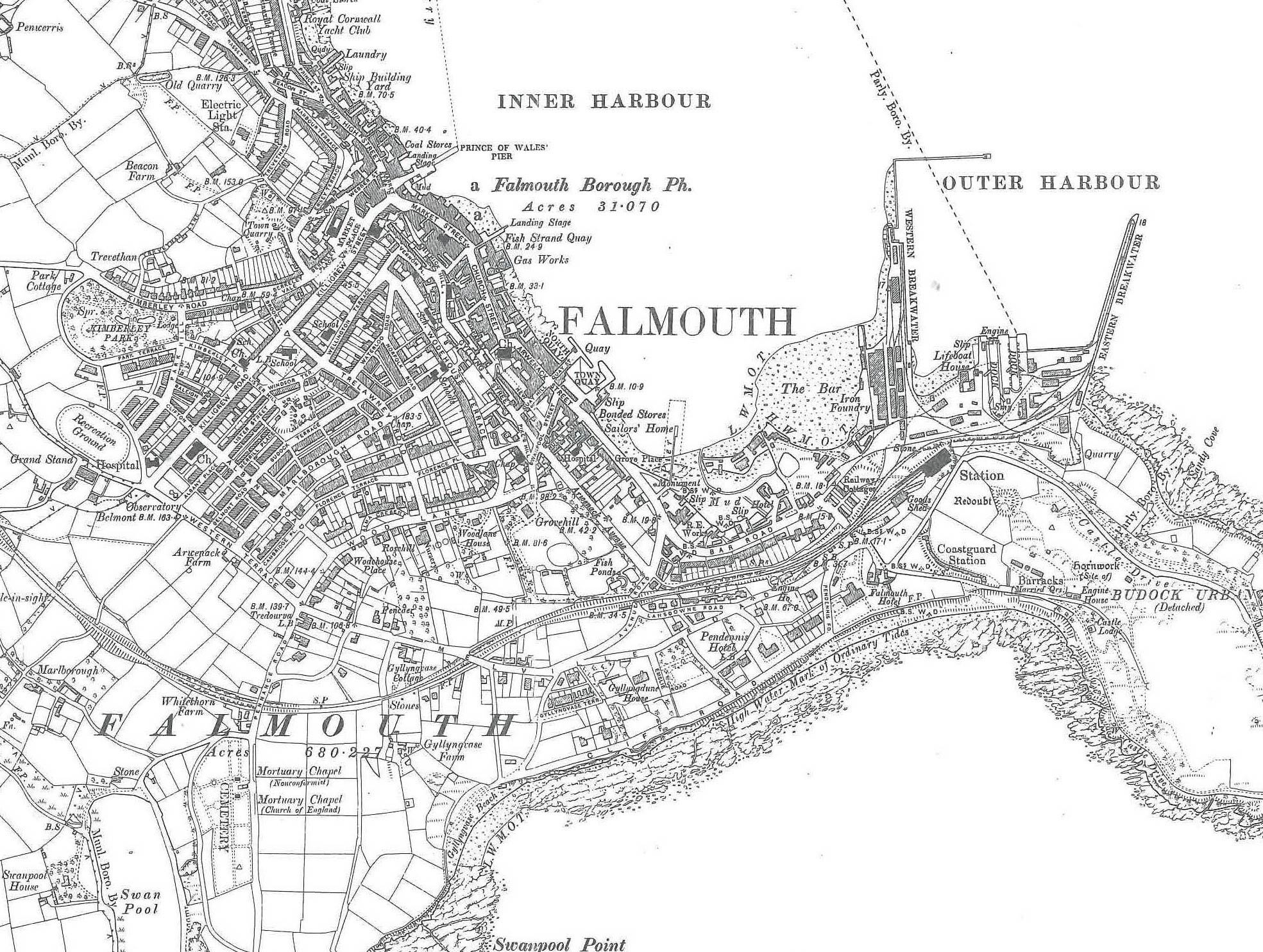
OS Map shows:
Royal Cornwall Yacht Club
Laundry
Ship Building Yard
INNER HARBOUR
PRINCE OF WALES PIER
Falmouth Borough Ph.
Landing Stage
Fish Strange Quay
Gas works
NORTH QUAY
TOWN QUAY
Slip
Bonded Stores
Sailors’ Home
The Bar
Iron Foundry
Lifeboat House
Slip
OUTER HARBOUR
Source Five- Map of Falmouth 1909
- Can you find where William and James work on this map? What does the map reveal about Falmouth in the past?