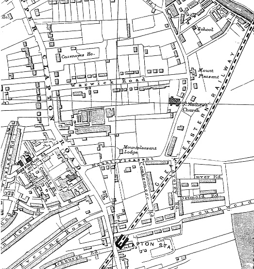
1. Look at Source 1. This is a map of Hackney from 1910.
- What things does it show?
- Are all the streets the same width?
- What work places are shown?
- Are there any parks or open fields, schools or churches?
- Can you find Conduit Street off Rossington Street?