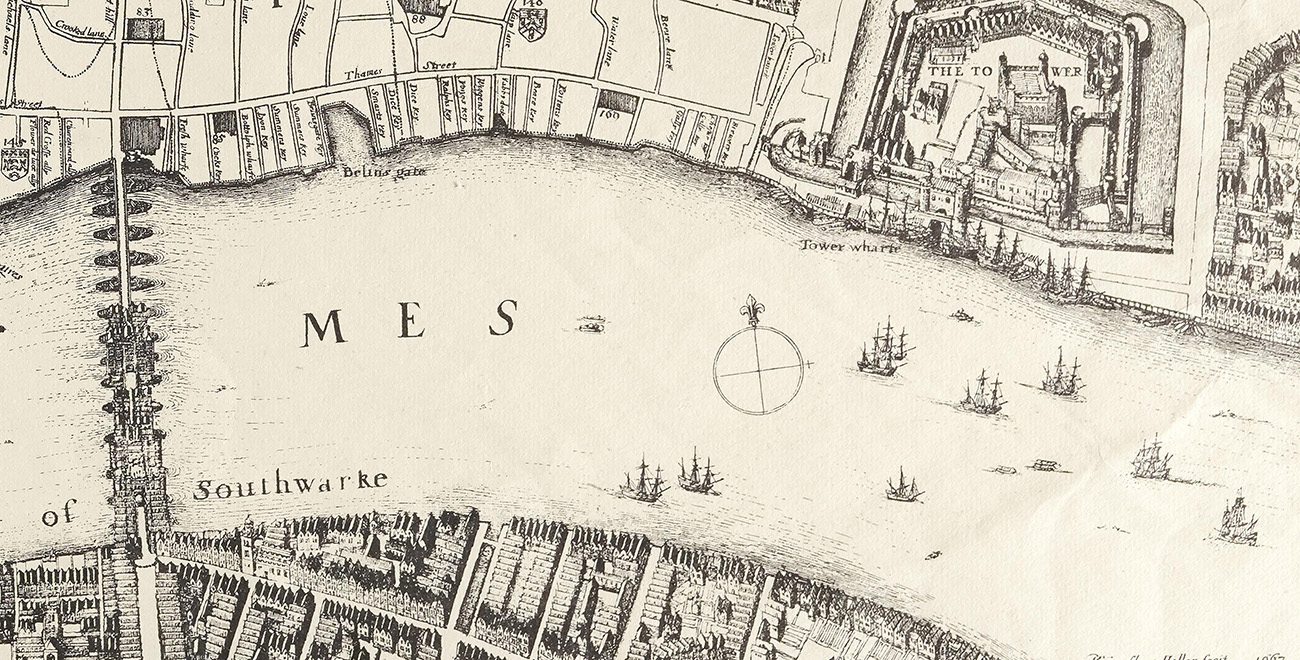
Close-up of the docks. Map drawn by Wenceslaus Hollar, entitled ‘Survey of the City of London’, 1667, Catalogue Ref: ZMAP 4/18
Take a look at this map of London, which shows some of the areas of the river Thames where trading ships would dock to unload their cargoes of sugar.
- What can you see in this map?
- How is map different from Source 1?
- Are there parts of the map which you recognise from London today?
- If there are docks for only sugar cargo, what does this tell us about the demand for sugar at this time?
- How would you describe the river Thames?
- How was the river Thames was used in the 1600s from looking at this map?
- Why do you think this map is useful for learning about life in London in the 1660s?
- What can a map show us which a written document cannot?