Download Inclesmoor map files:
- Inclesmoor map bottom left (.stl)
- Inclesmoor map bottom right (.stl)
- Inclesmoor map top left (.stl)
- Inclesmoor map top right (.stl)
- Inclesmoor map road markers (.stl)
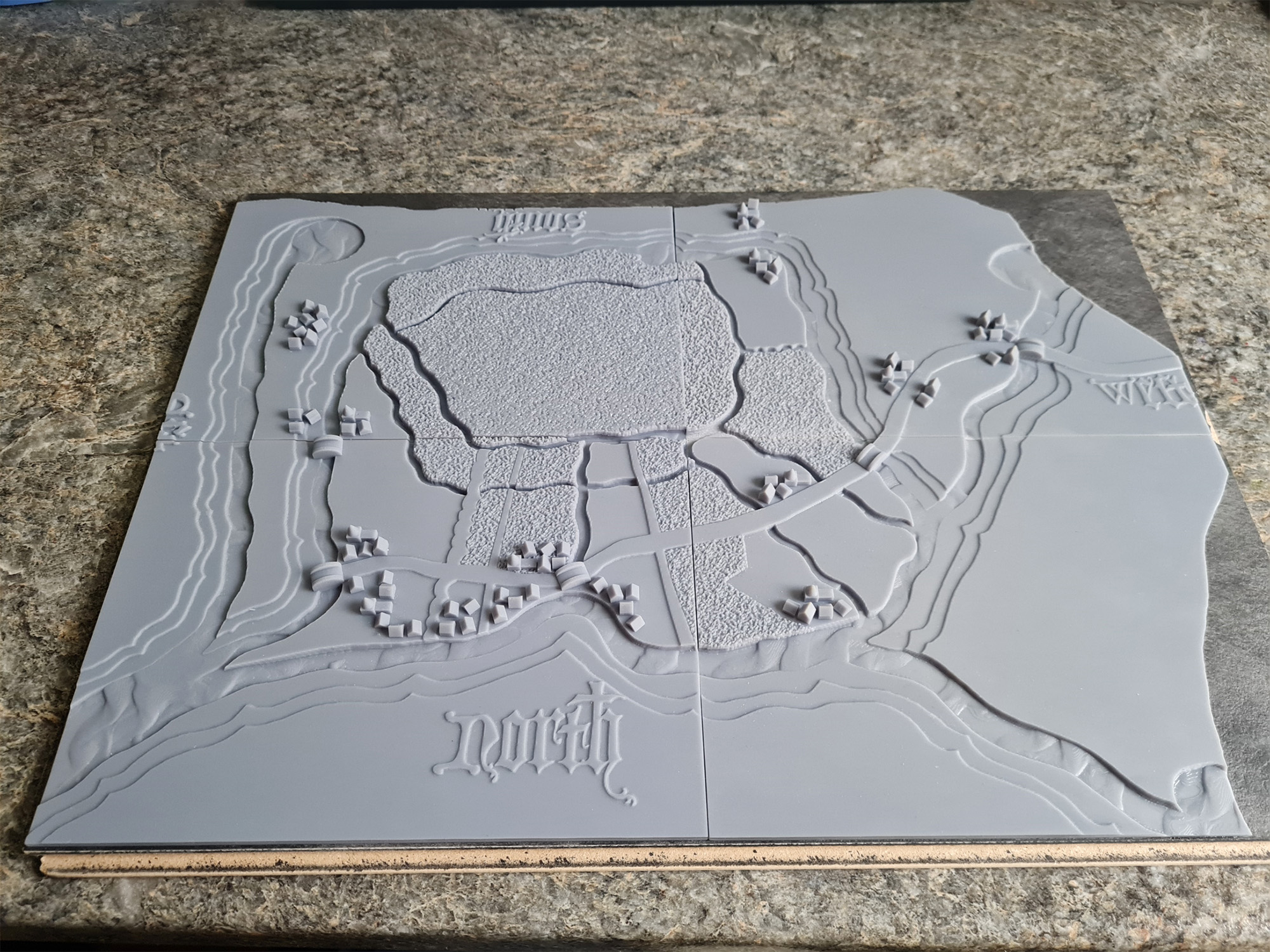
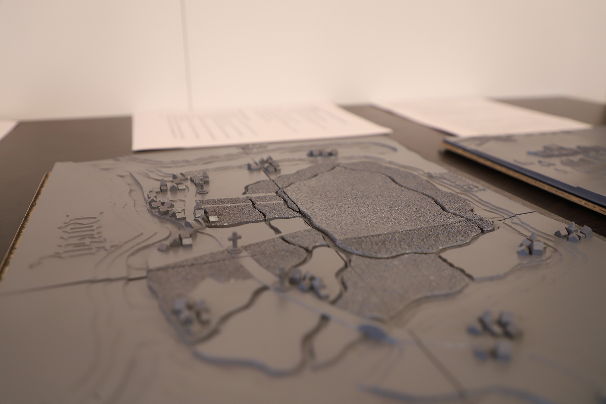
The Inclesmoor files contain four quarters, which are marked as top left and right, and bottom left and right.
Additionally, there is a separate road marker file, which is to be printed separately as many times as necessary, to add depicted road markers to their locations on the map. These road markers can be delicate, so the file has been provided separately so any breakages can more easily be fixed.
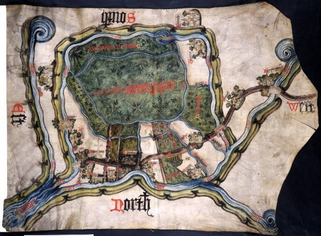
The Inclesmoor map, illustrating a land dispute, c.1450. MPC 1/56
This document is a map made in 1407, in medieval times. It shows an area of Yorkshire, in the north of England. The map was designed so a group of people sitting at a table could all read it.
This map shows the final agreement in a long argument between the Duchy of Lancaster, a powerful land-owning family and a church, St Mary’s Abbey, in York. The dispute was about who could use different areas of the land. Particularly, who was allowed to cut peat to sell for fuel. Peat could be burned. This is the moorland, the area in the middle of the map. Making maps was very unusual in the medieval times, therefore this is an extremely special document.
This document can be used alongside our lesson plan Medieval agreements and arguments.
Questions:
- What different areas of landscape does the map show?
- What details can you find on the map?
- Why do you think the map was made?
- Why do think the map is this shape? [Clue: think of an animal]
Challenge questions:
- What do you think the stone crosses mark?
- What was this map used for?
- Why was the map designed to be so detailed and impressive?
Images of the tactile model: