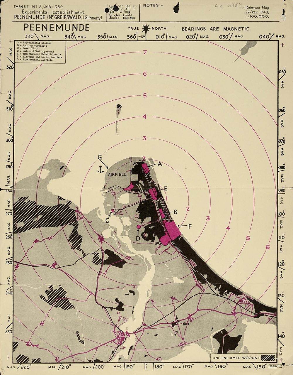
Peenemunde Site Plan/Target Map (AIR 34/632)
[To show key]
Peenemunde Site Plan/Target Map
Target No. 3 /AIR/389 Relevant Map
Experimental Establishment 22/Rev.1943
Peenemunde (Nr. Greifswald) (Germany) 1:100,000
PEENEMUNDE TRUE NORTH BEARINGS ARE MAGNETIC
[KEY]
A= Experimental Station
B= Factory Workshops
C= Power Plant
D= Unidentified Plant
E= Experimental Establishments
F= Sleeping and Living Quarters
G= Experimental Airfield
2. Look at Sources 3a & 3b: Attack on Peenemunde.
- Study the aerial photograph of Peenemunde (3a)
- Can you identify the areas listed here in Peenemunde Site Plan/Target Map (3b):
- Experimental station
- Factory workshops
- Power plant
- Unidentified Apparatus [machinery]
- Experimental establishments
- Sleeping and living quarters
- Experimental Airfield
- Which areas would you suggest the bomber pilots aim for?
- Give reasons for your choice of targets.