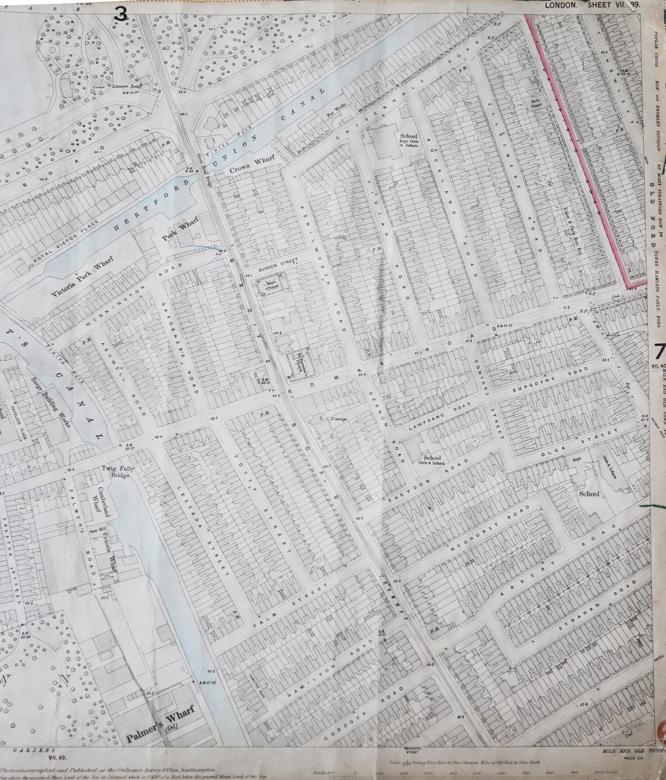
Map of the area around Grove Road from Victoria Park and Hertford Union Canal to Palmer’s Wharf. Rows of terraced houses line the streets with chapels, schools and pubs marked and industrial buildings shown to the west side of Regents Canal.
Source Four – OS map of Grove road 1893 – Tower Hamlets Local History Library and Archives (LCM 764)
- Look at the map of Grove road. What different buildings can you see? What does this tell you about this area?