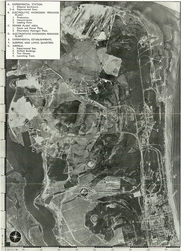
Aerial photograph of Peenemunde (AIR 34/184)
Transcript
A. EXPERIMENTAL STATION.
1. Elliptical Earthwork.
2-6. Experimental Sites.
B. ELECTROLYTIC HYDROGEN PEROXIDE PLANT.
1. Production.
2. Concentration.
3. Loading Point.
C. POWER PLANT AREA.
1. Steam and Power Plant.
2. Electrolytic Hydrogen Plant.
D. ELECTROSTATIC HYDROGEN PEROXIDE PLANT.
E. EXPERIMENTAL ESTABLISHMENTS.
F. SLEEPING AND LIVING QUARTERS.
G. AIRFIELD.
1. Experimental Site.
2. Airfield Buildings.
3. Test Houses.
4. Launching Track.
2. Look at Sources 3a & 3b: Attack on Peenemunde.
- Study the aerial photograph of Peenemunde (3a)
- Can you identify the areas listed here in Peenemunde Site Plan/Target Map (3b):
- Experimental station
- Factory workshops
- Power plant
- Unidentified Apparatus [machinery]
- Experimental establishments
- Sleeping and living quarters
- Experimental Airfield
- Which areas would you suggest the bomber pilots aim for?
- Give reasons for your choice of targets.