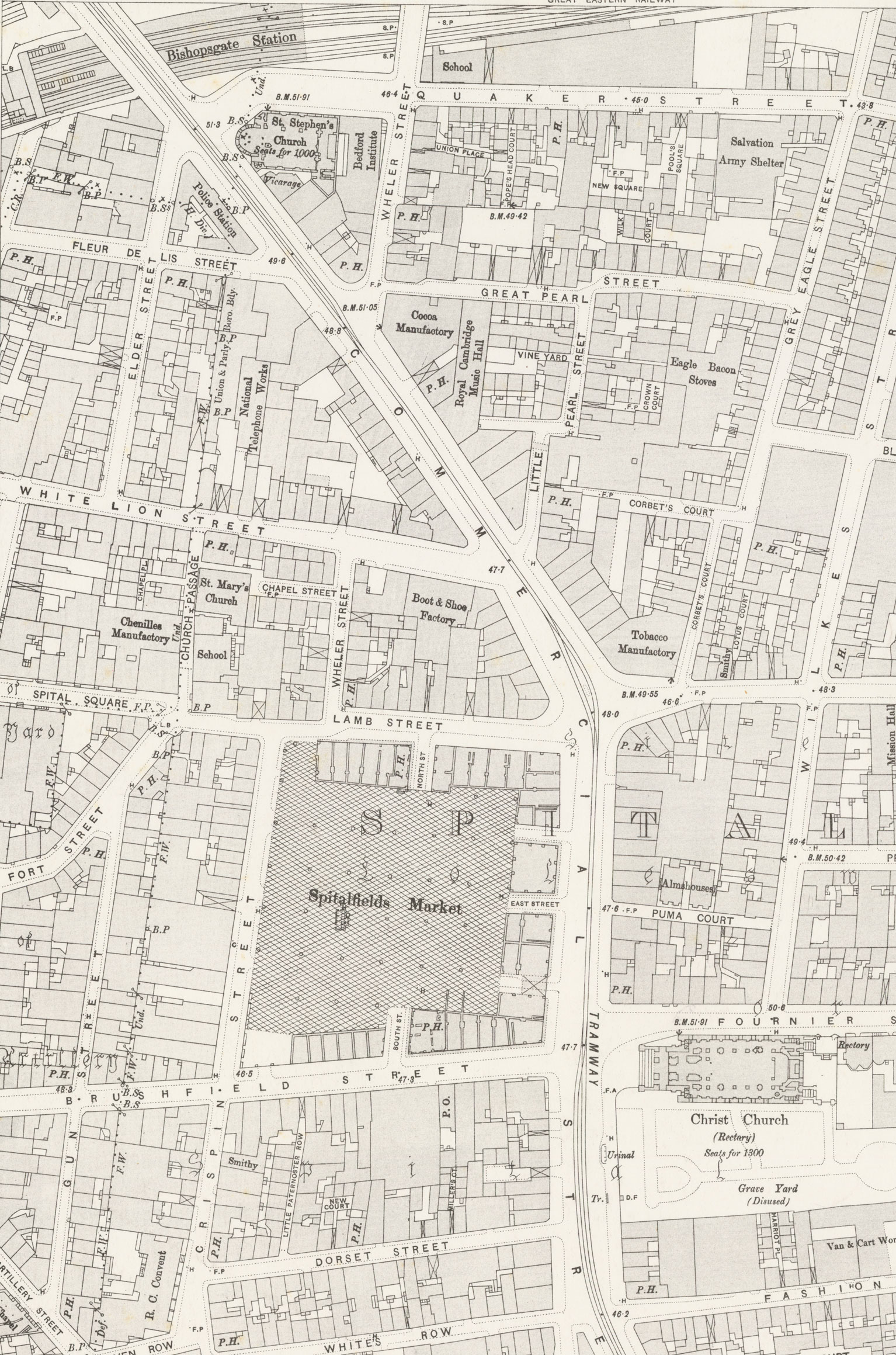
The Ordnance Survey Map:
- Can you find Commercial Street, Elder Street and Great Pearl Street (with Little Pearl Street leading off it to the south) on the map?
- What buildings are named on the OS Map? What do they tell you about the area?
- P.H. stands for Public House or Pub, how many can you find in the area?
Sources One and Two:
- What other features can you find on both maps? (Train stations, markets, churches etc.)
- What do these features tell you about the area?