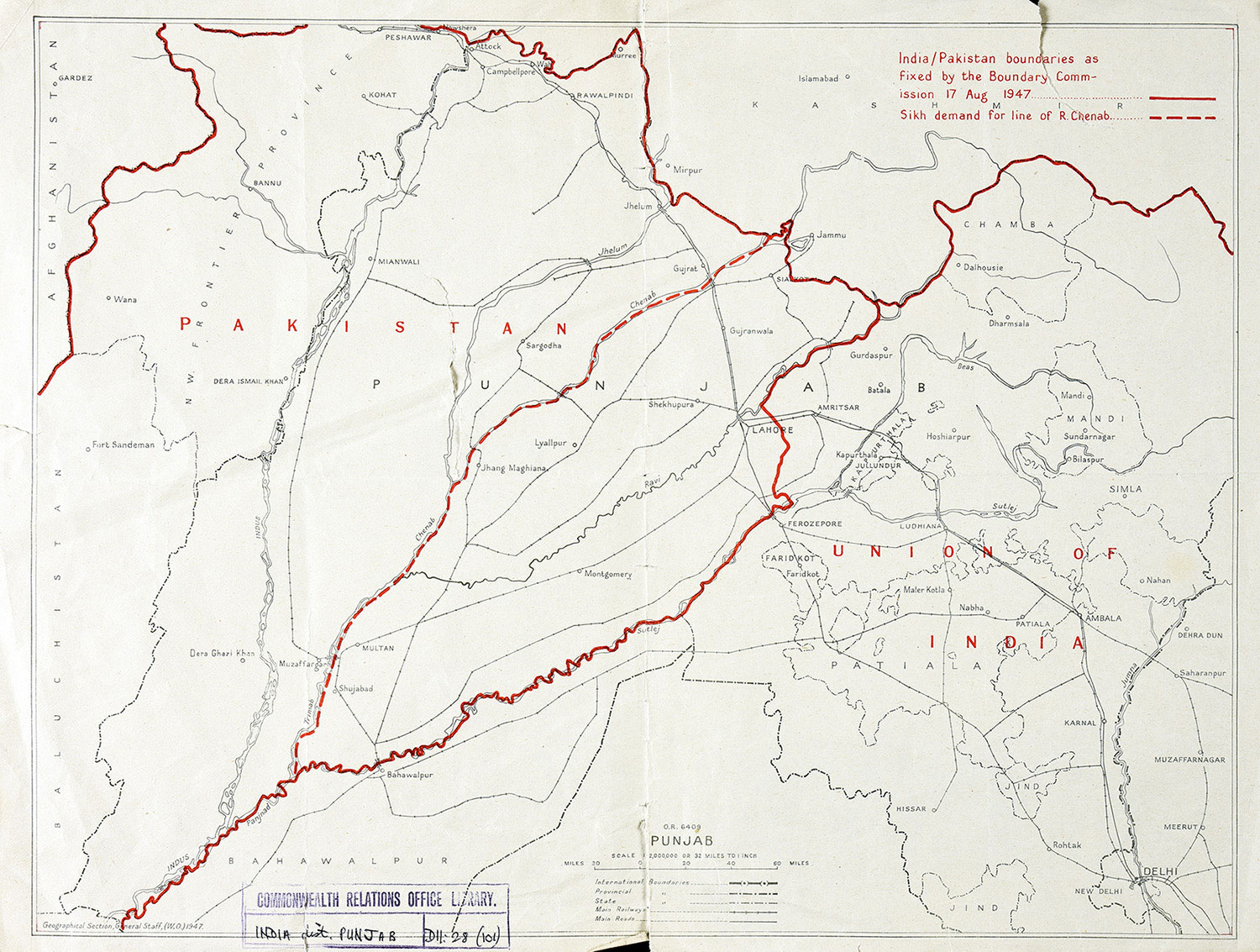
1947 map of the Punjab, India and Pakistan boundaries. Catalogue ref: CO1054/76
Context-
Lahore was a special place for the Sikhs. It was the location of many important Sikh religious and historical sites. In addition Guru Nanak, the founder of Sikhism, was born in Nankana Sahib, near Lahore. However this was a Muslim majority area and was made part of Pakistan. This didn’t take into account that non-Muslim people had strong connections to this area, they had businesses and had played a large role in developing the Punjab. Before the boundary line was drawn there were appeals from many in the Sikh community to give greater acknowledgement to Sikh history and heritage than they feared a focus on Muslim and non-Muslim populations would allow.
Map description
India/Pakistan boundaries as fixed by the Boundary Commission 17 August 1947: [Red line]
Sikh demand for line for River Chenab: [Red dashes]
PAKISTAN
PUNJAB
Red dashes going along the River Chenab, through the area of the Punjab. This shows the border that the Sikhs want.
In this area is the city of LAHORE
UNION OF INDIA
Red line showing the border of the UNION OF INDIA
These places are located in the UNION OF INDIA.
AMRISTAR
JULLUNDUR
FEROZEPORE
- What does the red line and the red dotted line show on the map?
- When do you think this document was made? Hint: Look at the date mentioned in the key.
- The boundary lines for Pakistan and India were drawn mainly by looking at the percentage of Muslim people in the population. What group of people may have objected to this and why?