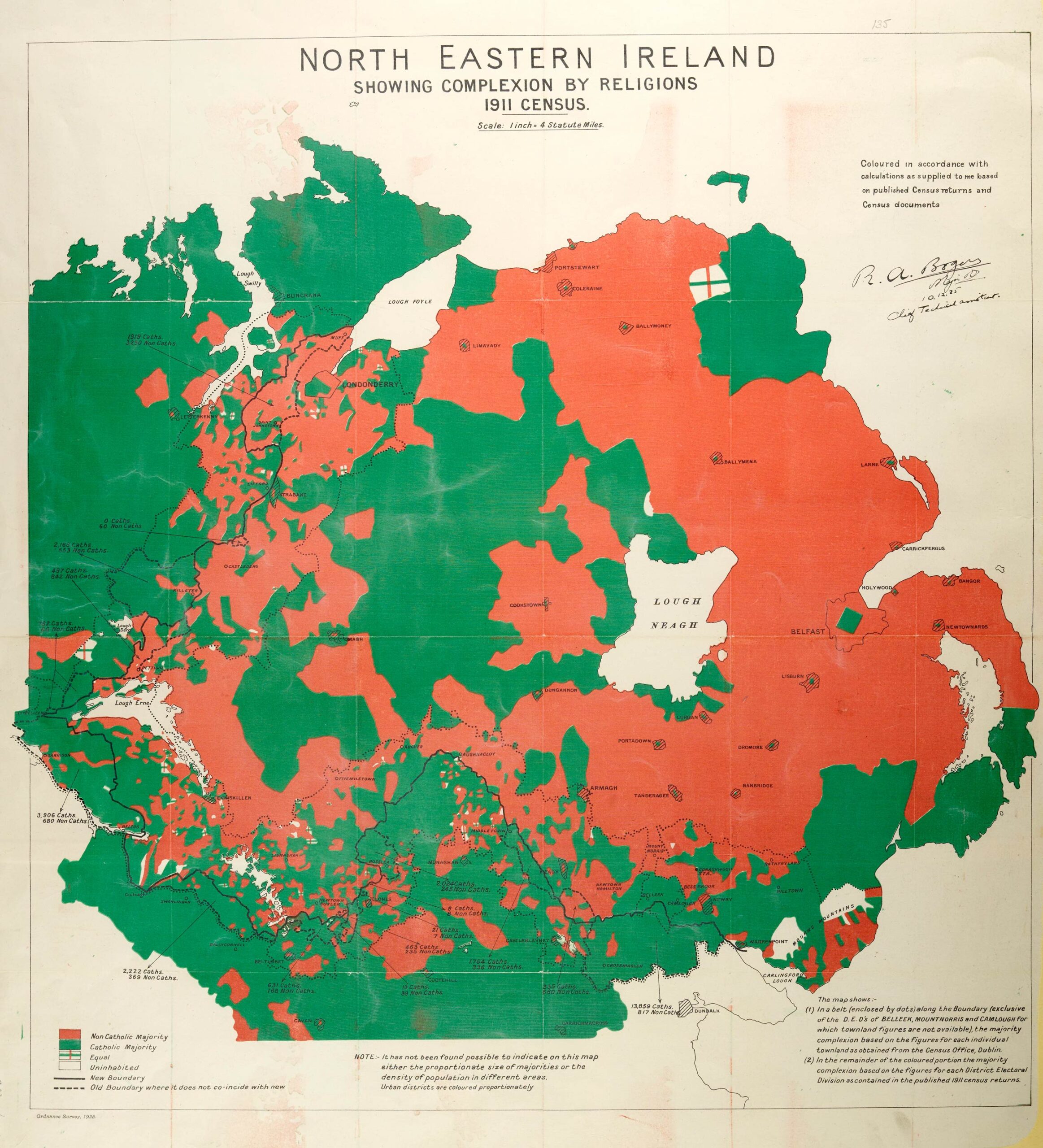
Map of Northern Ireland showing the religious breakdown taken from the Irish Boundary Commission, Catalogue ref: MPI 1/402
The Anglo-Irish Treaty had set out that an Irish Boundary Commission would be formed to finalise the border between the Irish Free State and Northern Ireland. It did not report until 1925, and recommended only minor changes to the border which had been set out in 1922.
It was feared that the decisions made by the Commission might cause additional unrest and so it was agreed by the Irish Free State, Northern Ireland, and the British Government, that the borders would remain as originally drawn. The Commission’s report was not made public until 1969.
Transcript
NORTH EASTERN IRELAND
SHOWING COMPLEXION [makeup] BY RELIGIONS
1911 CENSUS
Coloured in accordance with calculations as supplied to me based on published Census returns and Census documents
[RED] = Non Catholic Majority
[GREEN] = Catholic Majority
[CROSS] = Equal
[BLANK] = Uninhabited
[LINE] = New Boundary
[DOTTED LINE] = Old Boundary where it does not coincide with new
NOTE:- It has not been found possible to indicate on this map either the proportionate size of majorities or the density of population in different areas. Urban districts are coloured proportionately
- Which areas of Northern Ireland are shown as mainly Protestant?
- Which areas of Northern Ireland are shown as mainly Catholic?
- What was the religious makeup around both the old and new borders of Northern Ireland?
- What problems do you think this makeup could have caused for the Commission as it attempted to finalise the border?