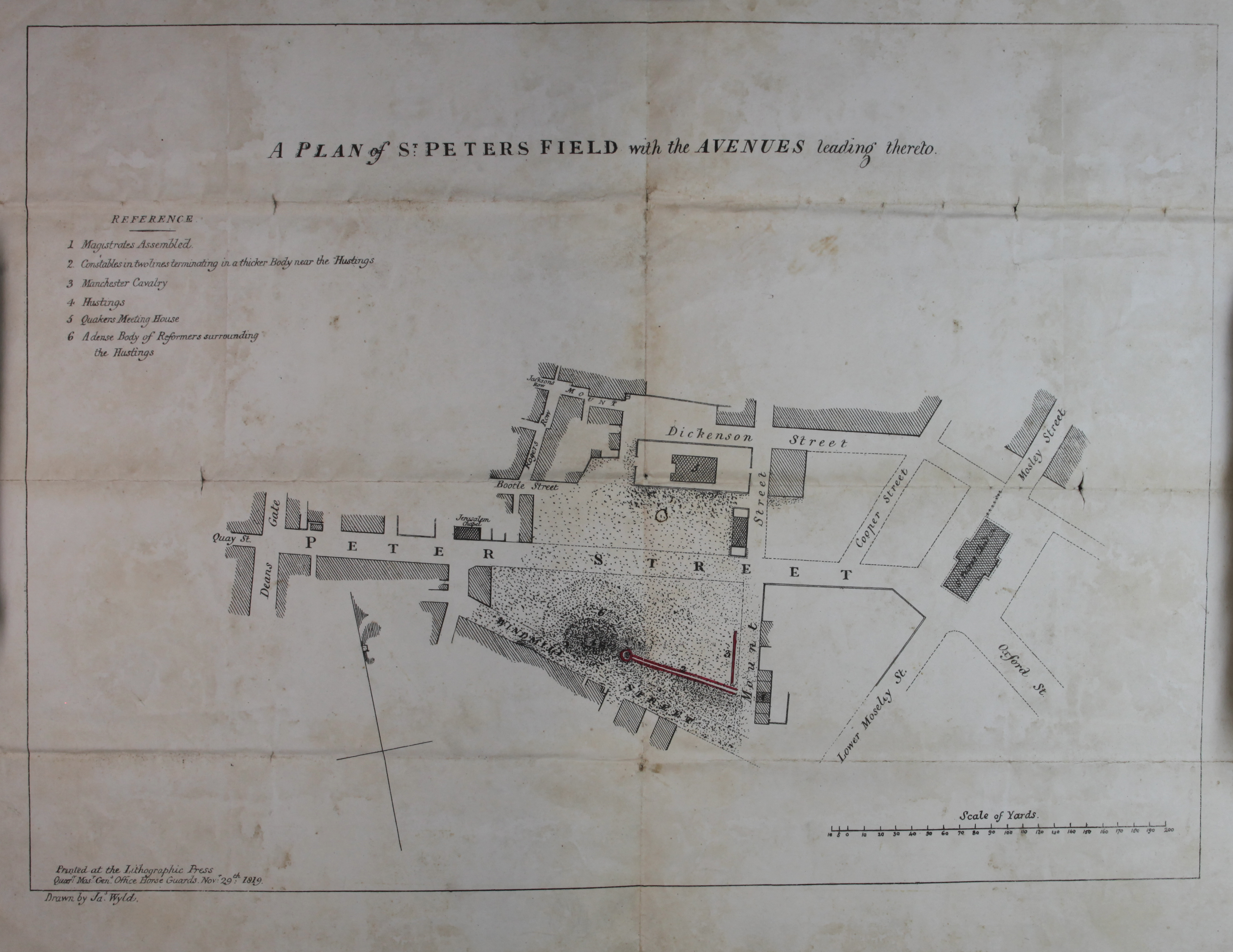
‘A plan of St Peter’s Field with the Avenues leading thereto’, with a key that shows the location of the magistrates assembled, constables near the hustings, Manchester Cavalry, hustings, Quakers’ Meeting House and reformers surrounding the hustings (catalogue reference TS 11/1056)
Transcript
REFERENCE
- Magistrates Assembled
- Constables in two lines terminating in a thicker body near the hustings
- Manchester Cavalry
- Hustings
- Quakers Meeting House
- A Dense Body of Reformers surrounding the Hustings
Printed at the Lithographic Press
Quarter Master General Office, Horse Guards, November 29th 1819.
Drawn by James Wyld.